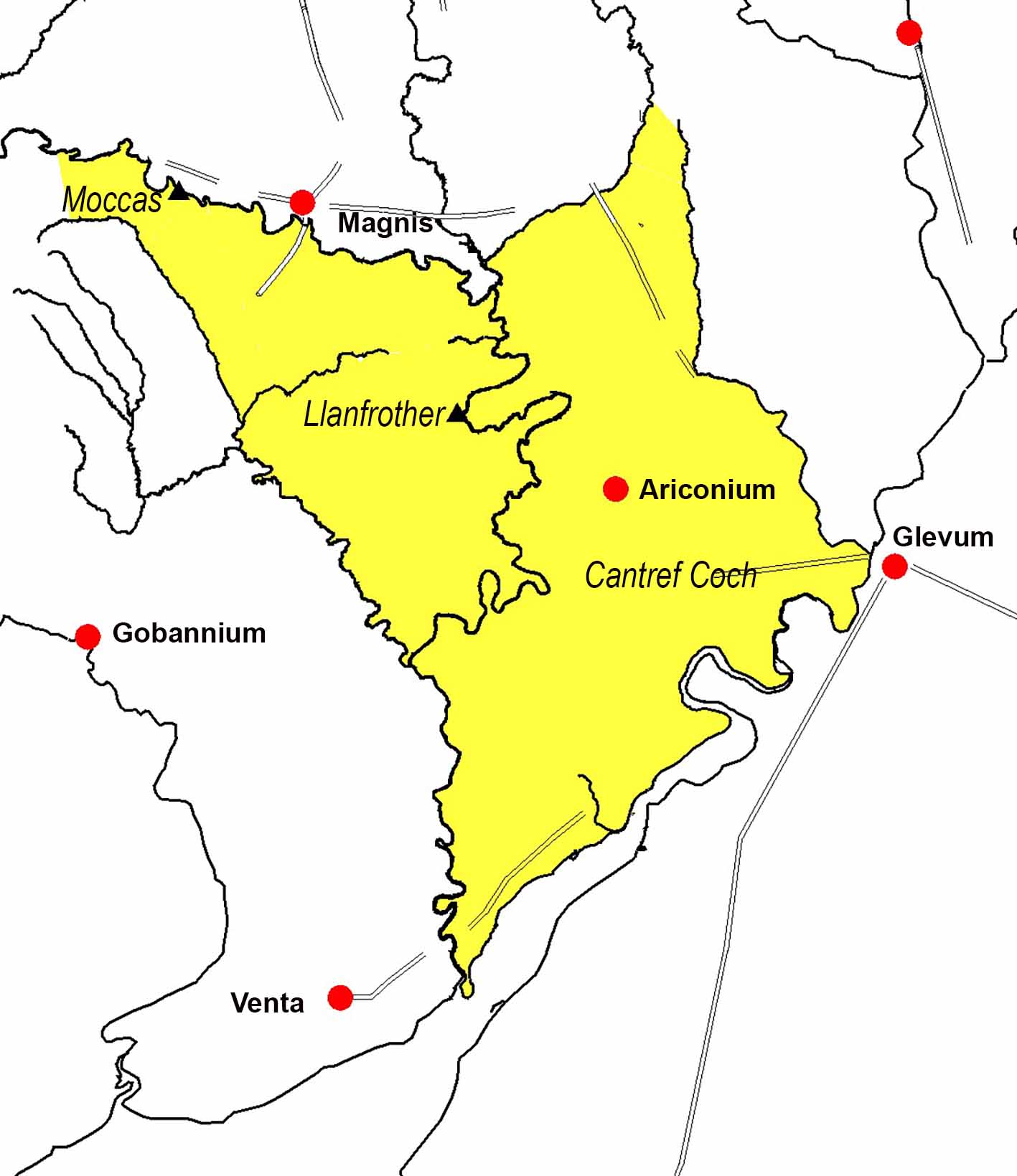
Ergyng seems to have been based on, and named after, the old Romano-British industrial town of Ariconium (Weston-under-Penyard in South Herefordshire)
To the west of Ergyng, the town of Venta (Caerwent) gave its name to the kingdom of Gwent.
Although Archenfield, the name that the English gave to Ergyng is, with the exception of the area of King's Caple to the west of the River Wye, Ariconium is to the east, suggesting that Ergyng was once much larger.
There is a Welsh tradition of Cantref Coch 'the Red Cantref', which extended as far as Glevum (Gloucester). Cantref Coch was lost to the English at an early date. According to the Anglo Saxon Chronicle Gloucester fell to the Saxons following the victory of Cuthwine and Ceawlin over the Britons at the Battle of Dyrham in AD 577.
With the Saxons in Gloucester, any Welsh territory to the east of the Wye - the Red Cantref - would have been exposed, and South Wales was under threat. The victory of King Tewdrig of Glywysing/Gwent against the Saxons at the Battle of Pont y Saeson on the lower Wye just above Chepstow in around 620 or 630 preserved South Wales and therefore Ergyng for a couple of centuries.
In northern Ergyng the area known as Mais Mail Lochou 'Mawfield' lay entirely within the area taken be the English in the 8th century; the boundaries were described as being from Moccas to the Dore to the Worm to the Taratyr and then along the Wye back to Moccas. Over time the English of Mercia and Wessex subjugated the whole of Ergyng which they called 'Ergyngafeld' - Archenfield
